Looking for a Great Deal? We’ll help you find it!
Geography
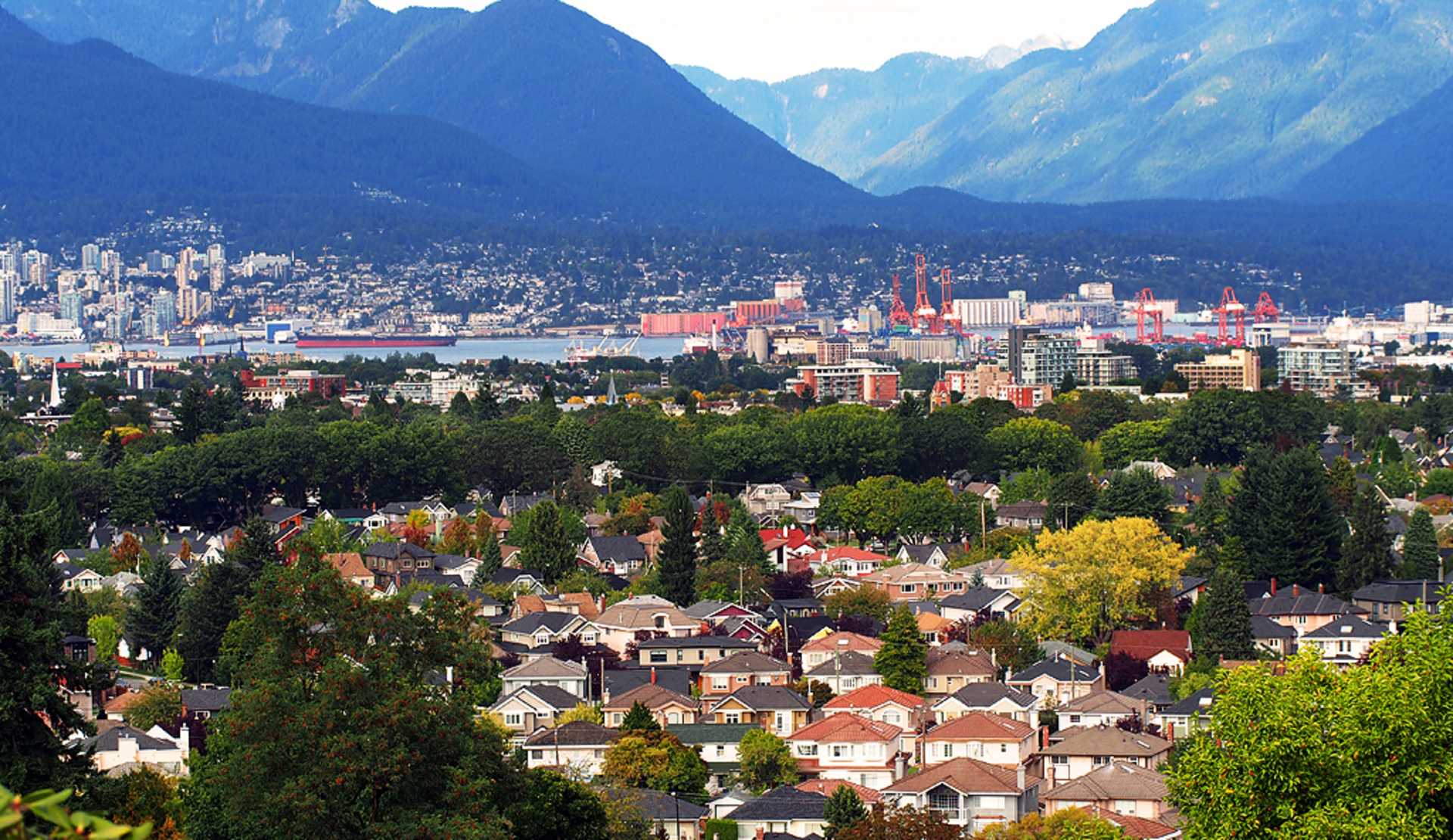
Metro Vancouver
Vancouver is located on the mainland of North America, in the south-west corner of British Columbia, the westernmost of Canada's 10 provinces and three territories. Metro Vancouver is made up of 21 municipalities that occupy 2,930 square kilometres on and around the Fraser River delta. The City of Vancouver is one of them. Roughly speaking, Metro Vancouver is bordered on the north side by the Coast Mountains, to the south by the U.S. border, to the west by Pacific Ocean, and to the east by the far end of the suburbs of Maple Ridge and Langley.
The City of Vancouver is on the far-western portion of a peninsula that is a major extension of the Fraser River's delta. The delta juts into a part of the Pacific Ocean, separating Vancouver Island from the mainland, called the Strait of Georgia. Several self-governing urban areas called municipalities make up Metro Vancouver. Directly north of the City of Vancouver is West Vancouver and North Vancouver, collectively referred to as “the North Shore”; bordering the east of Vancouver is the suburb of Burnaby, with Richmond to the south of the city.
The southern boundary of the City of Vancouver is the North Arm of the Fraser River, one of the largest rivers entering the Pacific. The Canada-U.S. border is 38 kilometres (24 miles) south of downtown Vancouver.
Across the Strait of Georgia and 96 kilometres (60 miles) to the south-west is British Columbia's capital city of Victoria, on the southern tip of Vancouver Island. Vancouver is almost exactly halfway between Western Europe and the Asia Pacific countries.
❐ See our pages on Metro Vancouver Municipalities for more information on the areas that make up the region.
❐ Or see our Maps section to better understand how Metro Vancouver is laid out.
City of Vancouver
The City of Vancouver is bordered on the north by Burrard Inlet, which is the city's main port. English Bay, a large body of water rimmed by beaches, and popular with those who love to sail, also serves as a freighter's 'parking lot' as they wait for berths in the harbour. English Bay marks the western edge of the Vancouver’s downtown core and the northern edge of the city's west side neighbourhoods. The Fraser River is the southern boundary, with the municipality of Burnaby bordering the east.
The downtown core of Vancouver, with English Bay on one side and Burrard Inlet on the other, is a peninsula that lies west-northwest (or east-southeast.)
❐ Learn more about the Neighbourhoods within the City of Vancouver.
❐ Or see our Maps section to better understand where Vancouver’s neighbourhoods are.
Streets
Streets in the City of Vancouver are generally laid out in a standard grid, with the main exception being areas that include large parks, hills and natural diversions. The streets on the grid run north-south and
the avenues are east-west. The avenues, for the most part, are numbered, 1st through to 77th, with two major avenues breaking that pattern: Broadway, which should be 9th Avenue, and King Edward Avenue, which should be 25th Avenue. All the streets are named, as are all the roads in the downtown core.
For historical reasons, the centre-line for block numbering east-west starts in the single digits on either side of Ontario Street, which is two blocks west of Main Street. Addresses east of Ontario are referred to as East Broadway or East 23rd Avenue, etc. Those to the west are West Broadway or West 23rd Avenue etc. As with other grid-style cities, each block consists of a possible 100 building addresses. An address on the block immediately to the west of Ontario Street will be between 0 and 99; an address on the next block will be between 100 and 199, etc. Odd numbers are on the north or west side of the street; even building numbers are on the south or east side of the street.
The block numbering north south starts at Triumph Street, which is on the City's east side, and almost at the City's northern edge. Since virtually all of the streets are south of that, only a handful of addresses need to add the word 'North', as in North Nanaimo Street. All the rest just give the road's name; 'south' is assumed.
Note: In many grid-style cities the block numbers correspond with the numbered roadways, but not in Vancouver. First Avenue is 16 blocks south of Triumph Street, so, for instance, the 5500-block of Knight Street, is at 39th Avenue.
Business and Shopping Districts in Metro Vancouver
The downtown business and shopping core of the City of Vancouver is on a smaller peninsula, bordered by the Burrard Inlet to the north, English Bay to the west and False Creek to the south.
Most municipalities will also have their own commercial areas. On the North Shore, business is concentrated in West Vancouver on Marine Drive, and in North Vancouver along Marine Drive, which turns into Third Street. In Burnaby, a lot of commercial activity is centred around the Metrotown shopping centre, while in New Westminster, you’ll find businesses and shopping along the Fraser River waterfront.
In Richmond, the business centre is largely retail and stretches for some distance, primarily along Number 3 Road. The municipality of Surrey, the largest in British Columbia, contains four main business concentrations: Whalley, Guildford, Newton and Cloverdale. There is also a large business centre in downtown Langley.